North by Northwest Rally 2021: Day 2
12 September ’21
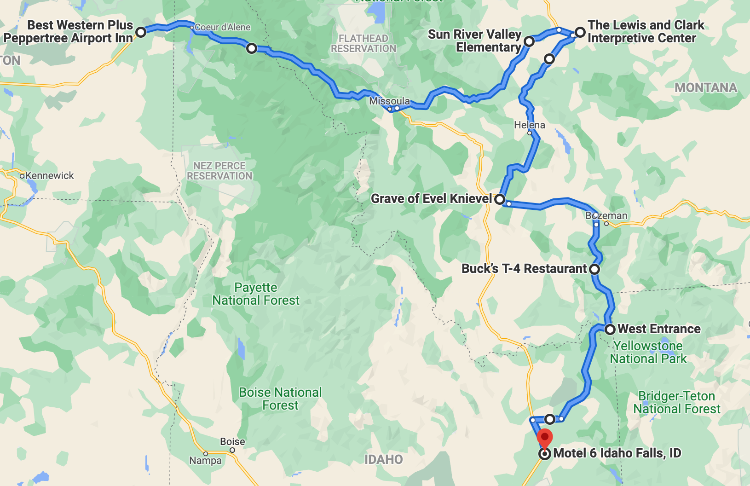
I was up and on the road by 4am; Doug’s bike was still in the lot, and as I chugged hotel coffee and stowed my rain cover, I wondered if maybe he didn’t have the right idea… I toyed with doubling back and heading down through Elk Valley and Lolo Pass, but my heart just wasn’t in it. I didn’t think that ~550 points would make much difference in the standings – certainly not enough to keep me from a podium finish – but more than that I just didn’t really want to go that way. It was dark and still raining and although somewhat rested after 5 hours in the hotel, I still caught myself thinking “y’know, it’s only 300 miles to home.. you could tell people the shock was just too worrisome..”
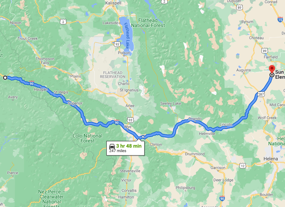
I decided to press on with my original modified plan, skipping those 2 bonuses and heading straight across I-90 to Missoula, picking up a couple hours in the process.
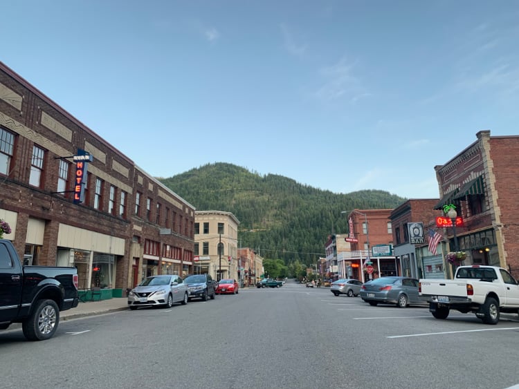
Spokane passed quickly in the rainy darkness, and soon I was climbing through the Coeur d’Alene National Forest. I’ve passed through this way a dozen times in the last four years, and in good weather (or daylight..) crossing the Idaho panhandle is a nice section of road, but in rain and darkness, it was just a bit of a tunnel. The rain slacked off and the sky was beginning to lighten as I pulled into Wallace, ID, which is a funky little silver mining town that has managed to hang on after the mines closed by a patchwork of tourism and vacationers.
Wallace, on a previous visit
There’s a couple good brew pubs, the bordello museum, a couple hotels, a decent coffee shop, and more real estate than a town of 950 should really have. I kind of dig it. I’ve stayed here 3 or 4 times as a good overnight spot ~370 miles from Seattle, most recently as Johanna and I were heading east to stage in New England for our 48/10 last summer.
WALLACE: Red Light Spaceship - Wallace, ID - 216pts
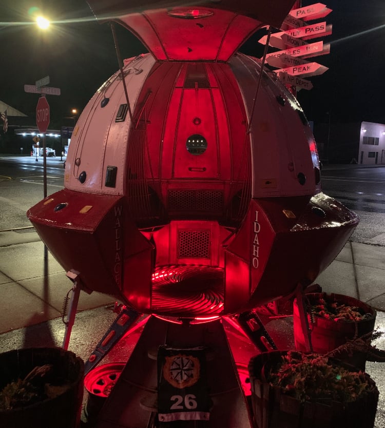
Take a photo of the Red Light Spaceship at these coordinates. If the hatch is closed, just leave it as-is and take your photo.
The Red Light Garage is a decent little diner/coffeeshop/burger joint, and has a great, eclectic collection of “art”.. and you can do worse than the Stardust Motel behind it.
Western Montana is one of my favorite places, and I-90 is almost always empty between Wallace and Missoula. Today was no exception, and with the rain go and the sun breaking, I found myself enjoying the ride for a change. I had plenty of time to my next bonus location, and I briefly gave thought to stopping off in Missoula to grab the final stamp I’d need for my 2nd National Parks Tour (Silver) of 2021, but I did the math and realized I’d be passing through 2 or 3 hours before the museum with the stamp would be open.. ah well, I could stop in Great Falls at the Lewis & Clark museum there and grab a stamp for Montana instead.
I stopped in St. Regis, as I always do, and used the facilities at the Travel Center there, bought a coffee and a breakfast sammich and sat outside on a bench, enjoying the meal. In truth, I probably wasted 20 minutes just sitting there staring off into space, thinking a lot of deep thoughts about my life and where things are heading for me in the next couple years.. as much as I love riding in the PNW, sometimes the memories are too much for even my welded heart to bear, and I need to just stop and breathe for a few minutes.
Missoula was quiet, for a Saturday morning, and I breezed right through onto MT-200, the “shortcut” to Great Falls. I went out to Great Falls to the infamous Sip-n-Dip back in 2019, part of my quest to get drunk in every mermaid bar in the country. What’s a mermaid bar, you might ask?
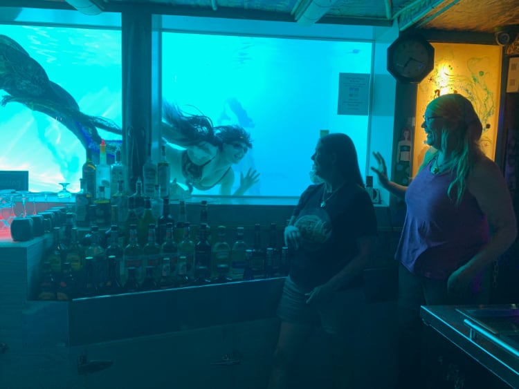
Bronwyn and I and a mermaid, back in 2019!
Nearing the bonus location, I passed a few other rally folks - or, at least, bikes I think I recognized from the farkles as rally bikes. I started to chew on the feeling of self-disappointment that I wasn’t competing and instead flower-sniffing, but was distracted by the first blast of wind to hit me as I dropped onto the prairie, leaving the protection of the forest and hills behind.
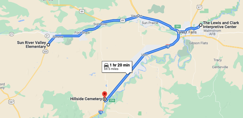
6CROWN: Crown Butte - Simms, MT - 462pts
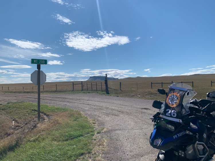
From these coordinates, take a photo of Crown Butte with the MT 200 sign in the foreground.
Super windy, to the point of being able to see it rock the 700lb GSA a bit. Getting my rally flag secured took a little creativity, but at least the rain had stopped!
As I headed towards my next bonus, I decided to stop and grab the National Parks Passport stamp at the Lewis & Clark Interpretive Center. It’s “right off the highway” but of course surface streets were blocked off, so I had to do a bit of a creative detour.
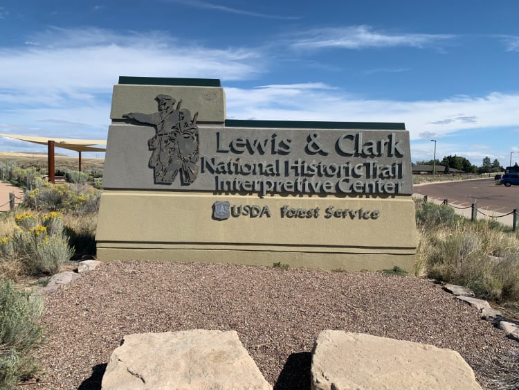
I chatted a bit with one of the docents - he had a Newfie dog (just like Lewis and Clark brought along) and wandered around the outdoor plaza, taking some photos and enjoying the sunshine while eating some lunch. I’m a bit of a Lewis & Clark fan, and my dad and one of his brothers visited here a few weeks ago on their motorcycle tour retracing the Lewis & Clark Trail. I wish I could’ve done more exploring, but as it was by the time I got to the highway, I’d burned another 40 minutes.
Retracing my steps, I got back out of downtown and soon was on the plateau again. I spotted something new - 2 pronghorns sparing with each other. A few miles later, one of the largest herds of pronghorn I’ve ever seen! I lost count ~30, easily twice that all told.
6SQUARE: Square Butte - Cascade, MT- 384pts
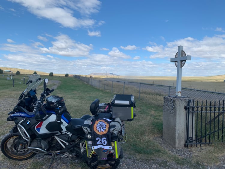
From these coordinates, take a photo of Square Butte with the Celtic cross in the foreground.
There was a short bit of freshly-graded gravel to get to the cemetery gate where I needed to take this photo, with the usual berm of “gravel slush” in the middle of the road. I fish-tailed a bit coming and going, but was more concerned about needing gas..
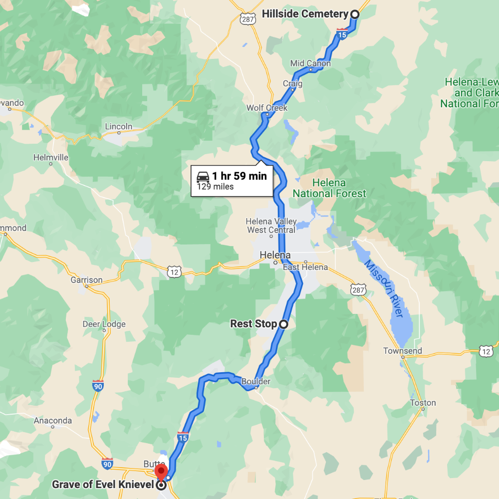
I had an epiphany as I was filling up the gas tank at the BP station in Cascade, MT - I wasn’t happy flower sniffing. In fact, I was… not ashamed or embarrassed, but disappointed in myself for pulling back and not giving it 100%. This thought tumbled around in my brain for the next hour, and I called Gabby to talk and distract myself for a bit, but lost her weaving through canyons on I-15. Dropping through Helena, the wind finally stopped trying to shove me off the bike, and I realized that I was tired and demoralized, and needed to stop for a bit and take a nap. Johanna called me right as I was looking for a rest area; I’m pretty sure she set alarms to call me during times of day when she knew I needed a break. I assured her I was about to take a nap, ate a few bites and sacked out on a picnic table for 20 minutes. I woke up MORE than refreshed, feeling like I could fight the whole world, ready to get my head back in the game. I might not be able to win, but I sure as hell could ride the rest of the rally like it mattered!
Another series of gorgeous gorges along I-15, which is a surprisingly scenic bit of interstate highway. You pop out on a high valley above Butte, MT, passing by the Berkeley Pit.. sadly, no good views of it from the road, but it’s just a giant hole in the ground at the end of the day… a giant hole that threatens to poison the aquifers that supply most of the mountain west.
EVEL: Grave of Evel Knievel - Butte, MT - 385pts

Take a photo of the east side of Evel’s gravestone - the side containing his dates of birth and death.
I ran into Ray Villeneuve here, and I heard all about his Day 1 woes – unable to take any photos due to a waterlogged cellphone and thus scoring no points on Day 1, he had changed up his plan to earn just enough points to qualify as a finisher. Yikes!
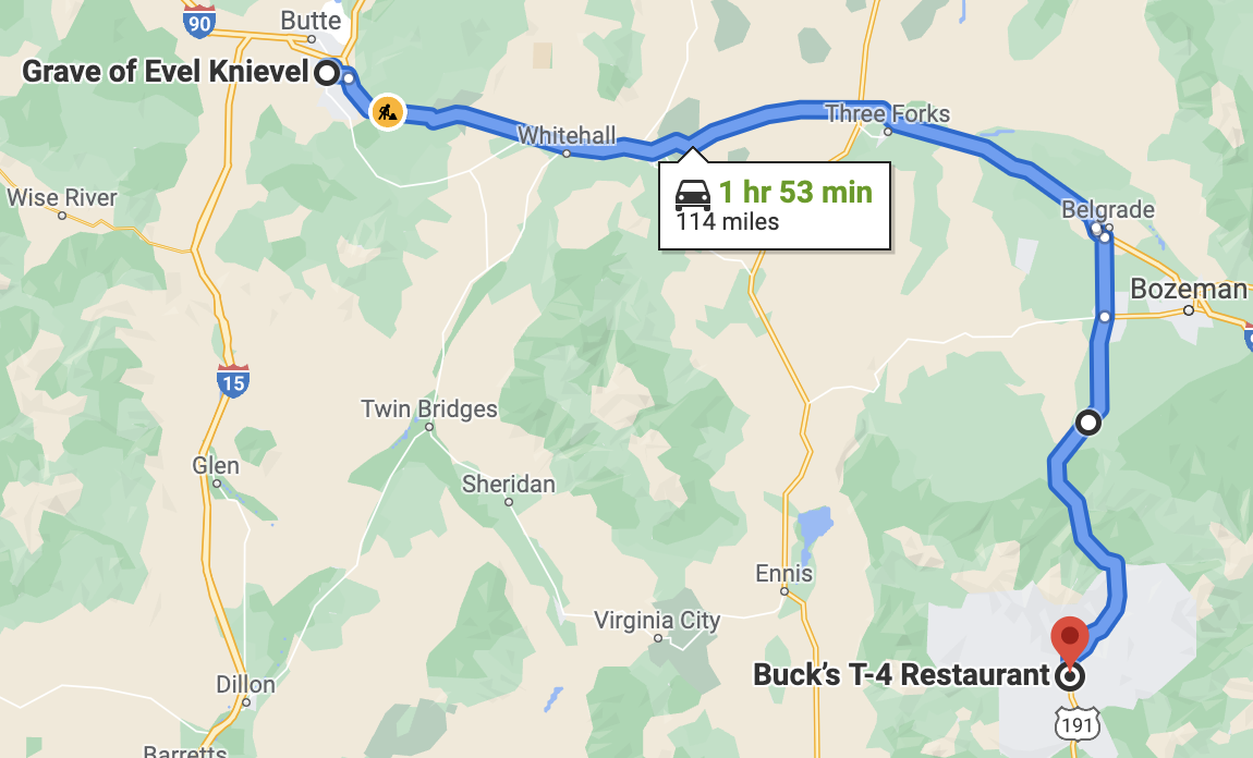
I pulled out of the graveyard and took a shortcut I knew of back to I-90. Once the Zumo figured out what I was doing, it agreed that this alternative route would save me 3 minutes.. I swear, I don’t trust this device anymore, at least not until I see an algorithm update.
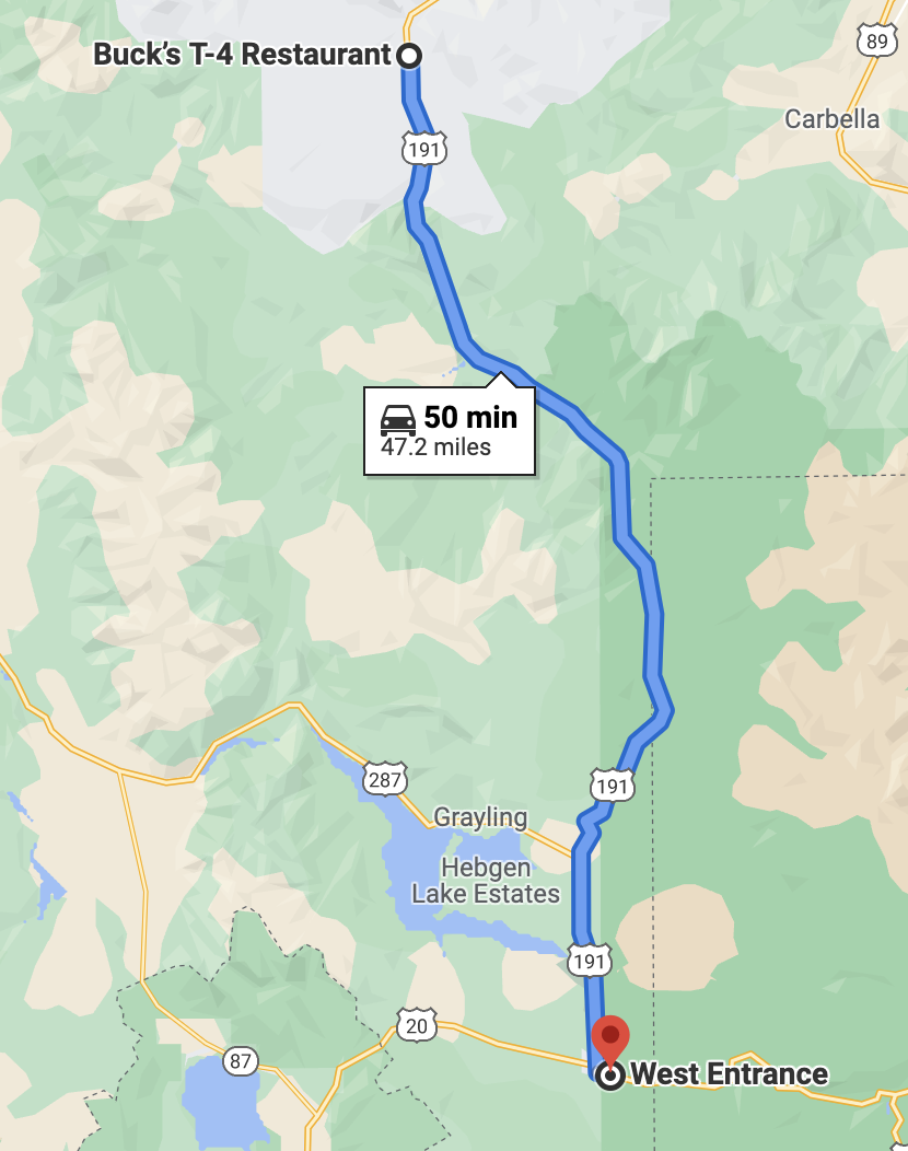
I-90 hops over a small range, past Ringing Rocks, and then back to the flat plains of central Montana. The sole saving grace is that the speed limit hops up to 80, which is always fun. Wheeee! I called Johanna and we chatted a bit about where I was at in terms of feeling competitive again. A brief stop in Belgrade, MT, changing from I-90 to first MT-85, then US-191. Frustrating amount of traffic going 5-10mph under the limit, lots of RVs, as the road is the northern access route to Big Sky and West Yellowstone, but I managed to find passing opportunities, and after some lovely canyon riding along the Gallatin River, I found myself in Big Sky, MT.
BIGSKY: Buck's T-4 Lodge - Big Sky, MT- 305pts
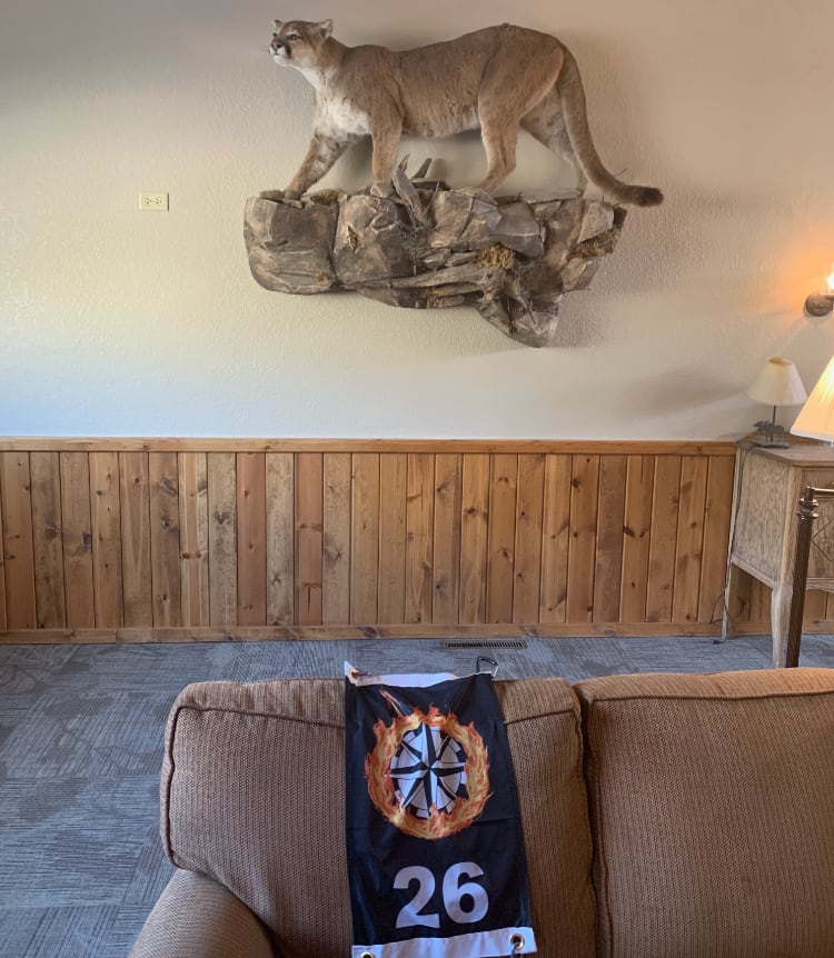
Take a photo of the mountain lion at these coordinates. It is located inside, about 40 feet beyond the hotel lobby/check-in area, and is not hard to find. You may get some strange looks and/or questions from hotel staff. Be nice.
Stepping inside the lobby, I start to explain to the desk clerk “Hi, this might sound weird, but I’m part of a scavenger hunt and-“ only to be cut-off and pointed to the back wall with a laugh. After I got my photo, I thanked her, and she said I was the 5th or 6th to come in asking about it.
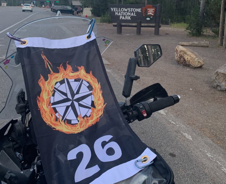
Briefly said hello to a couple from Massachusetts in the parking lot, then headed off again. It got noticeably cooler rolling up into the mountains. I stopped to obsessively check on my rally flag (yep, still there!) and soon enough crossed into the extreme NW corner of Yellowstone National Park, US-191 flirting with the Montana-Wyoming state line before finally dumping me in West Yellowstone. I’d been here once as a child, when we did the traditional station wagon vacation from New England. I don’t really remember much about it from that visit, besides a bookstore where I bought a copy of the Lewis & Clark journals (abridged..) but today it’s really just a big tourist trap - bars, t-shirt shops, candy stores.. the usual junk. Busy as heck, too. I got my bonus photo, stopped to use the restroom at a city park, and then skedaddled, pointing the bike west and back towards the barn for the first time this rally.
6YSTONE: Yellowstone National Park - West Yellowstone, MT- 147pts
Take a photo of the Yellowstone National Park sign at these coordinates.
I couldn’t get as close to the sign as I wanted to, due to a huge crowd of people.. of course, once I’d gotten the flag setup to take the shot, they’d all returned to their tour bus and moved out. This also closed out COMBO6, worth 2100 points.
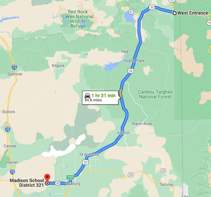
I called Johanna back, and we talked a bit about my rest bonus plans. I’d originally thought of West Yellowstone <-> Rexburg, ID as a good landing spot for claiming an 8-hour Rest Bonus, but it was way to0 early for West Yellowstone, and there was nothing available near Rexburg (which I’d be hitting around 7:30pm). My next plan was to find something in Arco, but again, everything was booked solid, so the only option was to make Idaho Falls work. I did some poking at the GPS while riding, and figured that even though Idaho Falls was a 20-mile detour, it would only about 10 minutes after all, so I asked Johanna to book me a room.
The ride down to the next bonus, Menan Buttes, was more of the same, through the Caribou-Targhee National Forest. Fishing camps and the small towns that service them, big open roads, very little traffic other than the occasional RV or trailer to block things up. Eventually the trees thin out and fields of circle irrigation appear. Lots of goats and horses, Mormon temples in each town I pass through, pushing towards the setting sun. I tucked in behind an Idaho state patrol and followed him for 20-30 miles.. it’s always oddly frustrating to follow police, because now I’m hyper-aware of my bad habits and desire to be 10-15mph over. This one was friendly enough, and probably heading home for the night, since he set cruise control for 6-7 over and didn’t play any speed-up/slow-down games with traffic, trying to bait someone into a violation.
I got to Rexburg about 15 minutes before the sun actually set, and I hopped over to ID-33 towards the Menan Buttes roadside marker for my next bonus just as the sun dipped below the horizon.
3MENAN: Menan Buttes - Menan, MT - 313pts
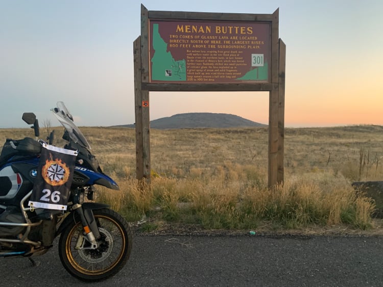
Take a photo of the Menan Buttes sign at these coordinates. If it is daylight, include the north butte, framed under the sign as in the sample picture.
I’ve been really impressed with the ability of the iPhone to take low-light photos. The sun is actually fully set here, but it looks almost like daylight! It pays to practice with your camera, and learn how to take good photos with it in a variety of conditions.
From here it was a short run down to Idaho Falls. I gassed up and got my Rest Bonus Start receipt at 8:40pm across the street from my hotel, got my bonus claim form updated while scarfing down a really healthy meal of deviled ham spread on carb-balance tortillas, half a granola bar, and 2 bottles of electrolyte beverage, and sacked out by 9:30pm, my alarm set for 4:25am.
This ended up being a great day. The weather cooperated, saw some new sights, visited some old standbys, and went to bed feeling like I still had another few hours of energy if I’d needed to push; I gave some thought to heading straight through to the next bonus and then on to Boise, but it it was looking like a few hours of riding through some really empty parts of the Snake River Plain, and I could use the rest now.
Day 2:
Miles: 819
Points: 4,312
Running Total:
Miles: 1,561
Points: 6,906